
Geo Data
Digital Maps for Network Design Tools
TeleResources have been providing high quality Geo Data for Telecom and GIS markets for the last two decades.
TeleResources can provide data sets in variety of Resolutions for any area of the globe ranging from 1m (3D), 5m (3D/ 2.5D) to 20m (2D) order of accuracy. By ordering this data through us we are able to ensure that it can be used by our Software.
With over 20 years of experience, TeleResources in conjunction with its partners specializes in delivering data creation and management solutions. Our combined comprehensive service portfolio encompasses a wide range of activities, including geospatial data capture, conversion, processing, integration, maintenance, and updates.
We adopt a consultative approach to thoroughly comprehend our clients’ business requirements. These needs are then translated into efficient, technology-driven workflows utilizing TeleResources intense market experience. Throughout the process, we ensure rigorous monitoring of these workflows, employing our QCDS framework.
Our clientele comprises both government and private sector entities who rely on geospatial data for internal or external systems. Our service offerings range from GIS managed data services to bespoke projects and staff augmentation. For situations or customers with stringent data sensitivity and information security requirements, we provide on-site activities.
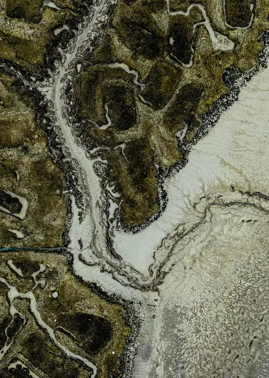
Geo Data Types:
TeleResources have the ability and is an industry leader in supplying high quality maps. These are available in different formats and specification based on the requirements. Our top-tier geodata package offers digital maps with high resolution (1-2m), featuring detailed 3D building and vegetation polygons. These maps are tailored for RF planning purposes, which is crucial for precise planning of 5G networks in densely populated urban regions, particularly at mmWave frequencies. In cases where lower resolution data is sufficient, we also provide a 2.5D medium resolution option (5-10m), which is well-suited for suburban areas. Additionally, we offer a 2D low resolution alternative (20m+) for extensive nationwide coverage.
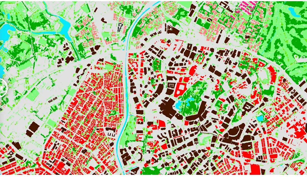
2D Regional Data
2D Data is typically produced in 10m, 20m, 50, & 100m Resolution.
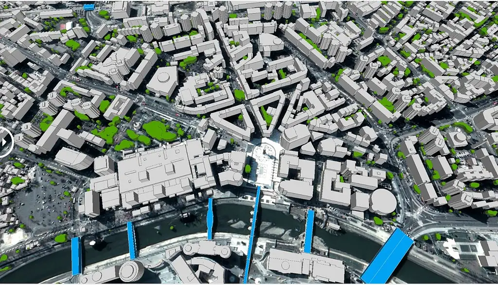
3D Geo Data for Urban areas (Highly accurate Individual building and Trees)
3D Data is typically produced in 1m, 2m, 5m Resolution using Stere images.
TeleResources have a range of (Off-The-Shelf) OTS inventory available which have been prepared for Telecom Operators around Australia/ New Zealand and Pacific.
Customer Story: High-Accuracy Geo Data Enables Better 5G Planning
As part of their 5G rollout, operators in Australia and New Zealand faced a key challenge:
standard geo datasets were not accurate enough to support reliable 5G NR propagation—especially in urban and suburban areas with complex terrain and dense building structures.
The Challenge
Need for high-resolution building heights, clutter, and terrain data to support 5G and beamforming simulations
Inaccurate predictions using standard datasets led to coverage gaps, rework, and poor customer experience

Our Solution
TeleResources supplied premium, 5G-ready Geo Data, including:
2–5m resolution DSM/DTM
Detailed 3D building footprints with height
Clutter & morphology classes optimised for 5G NR
Fully compatible with Atoll & Aster models
The Impact
Up to 20–25% improvement in 5G prediction accuracy
Reduced redesign & site rework costs
Better indoor coverage planning
Stronger customer retention due to improved network performance

Powering the future of mobility with reliable EV charging solutions.
Copyright © 2026 – TeleResources Pakistan. All rights reserved.
Created By Hamza Latif